Showing posts with label "Bahamas Trip". Show all posts

Monday, July 3, 2023

June 2023: The Bahamas (Again)

Great Fun with Lots of Batts...Damned Things
Weigh 65 Pounds Each
After spending two weeks in the Keys in May (followed by a short land trip to St. Louis for some family time in early June), planning for a 11-day sortie to the out islands in the Bahamas in mid-June probably wasn’t smart timing.  But we managed to pull it off.  The initial plan was formulated nearly a year ago by our Grady-White boat club, and long before Hurricane Ian’s prolonged strafing run forced some of our club members to opt out.  It also originated before two of Ghost Rider’s four AGM batteries died while down in the Keys, necessitating a rather hasty replacement effort; that was no fun, but with Fred Granger’s help we got it done in time.

Rick had plenty of time to plan the routes, which was fortunate as no two chart sets seemed to agree about the best routing through some of the shallow areas on the shoals and shallow banks.  In the end we always deferred to the Explorer Chartbook sets, which – as their web site clearly and accurately states (LINK) – are the gold standard for Bahamas cruising.

A few other boats from our Grady-White club joined us for the adventure:

  •               Ron & Brenda Ingram on their 335 Freedom, Open View (plus 4 guests)
  •                Bob Chapman on his 335 Freedom, Dilly Dally (plus two guests)
  •               Tony & Carla Vandenoever on their 306 Canyon, Little Bird
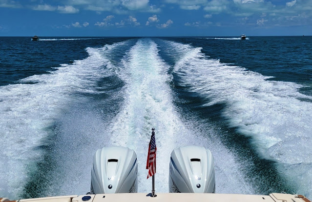
Open View and Little Bird in Trail Behind Ghost Rider En Route to Key Largo

And aboard Ghost Rider we were joined by Rick’s sister, Lin.  So altogether we had 14 folks join the adventure, with planned stops at Key Largo (Florida), Chub Cay (Berry Islands), Cape Eleuthera, and Staniel Cay (Exumas).

Sunday, 11-June: To Key Largo

The first day was all about getting to Key Largo in the northern Florida Keys, so we could stage our Gulf Stream crossing from there the following day.  We rendezvoused at the Sanibel Causeway at 0900, with Open View and Little Bird falling into formation behind Ghost Rider (Bob on Dilly Dally had departed the day before) and headed south in perfect weather conditions – a warm, summery day with light breezes and flat seas, and only had to deviate slightly for one heavy shower in Florida Bay.  
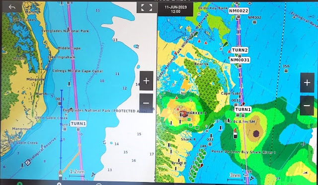
The Weather We Dodged as Shown on the XM Satellite Display on the Right

After clocking 155 nautical miles we were topping off fuel tanks in Key Largo by 1500, and then docking up at Marina Del Mar for the night.  We enjoyed a group dinner at Skipper’s dockside restaurant, checked the next day’s weather forecast (good enough), enjoyed a night cap, and got some sleep.

Monday, 12-June: To Chub Cay

We were off the dock by 0800 and motoring east shortly thereafter.  A few storms were draped along Florida’s southeast coast, but out in the open water we had good weather again.  But sea conditions were pretty lumpy for the first half of the crossing – quartering off the starboard bow at 2 to 3 feet, with the occasional 4 footer tossed in just to juggle your eyeballs a bit.  Initially that required deploying full trim tabs, but eventually the 15K winds clocked around to a southwesterly flow, and the ride improved (much to sister Lin’s relief.)  After we cut through the shoals at South Riding Rock (about 20NM south of Cat Cay), the ride improved even further.  We managed our route to bisect a couple of small thunderstorm cells shortly thereafter, and arrived at Chub Cay at the southern tip of the Berry Islands around 1430. 

The Long and Rather Bumpy Leg from Key Largo to Chub Cay

The check-in process there was chaotic – an impressive thunderstorm lashed the area shortly after our arrival, systems were slow and the Internet was sclerotic.  Eventually we got a ride to customs and immigration located at the nearby airport, after which we took down the Q-flag and raised the Bahamian courtesy flag.  We had dinner on the boat and crashed for the night.

It Stormed Heavily Shortly After We Arrived at Chub Cay

Tuesday, 13-June: To Cape Eleuthera

All boats spooled up at 0745 and headed to the fuel dock to take on more fuel before the next 102 NM leg to Eleuthera.  The Chub fuel dock was rationing, limiting each boat to 120 gallons, but that was more than enough for the day.  By 0900 we were underway again and headed southeast through 2-3 foot seas and sunny weather towards New Providence Island and Nassau, the capital of the Bahamas.  We skirted around Nassau Harbor via a skinny passage appropriately called “The Narrows”, going from a few thousand feet of depth to a section of the Great Bahama Bank that averaged about 14 feet deep – except where coral heads sprout upward to just a few feet below the surface.

Our Path From Chub Cay to Cape Eleuthera

But we managed to keep the boats off the bottom, and cut through another narrow passage at Highbourne Cay to cross over into Exuma Sound, where depths once again were measured in thousands of feet.  From there, a 25 NM jog to the northeast brought us to Cape Eleuthera around 1330.  Tony and Carla in Little Bird went about 10 NM further to the northeast for their lodging in Rock Sound.

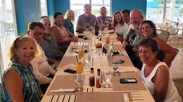
Cape Eleuthera is a large, well-protected and deep harbor.  Its fixed, wooden docks were in good condition, and all facilities – guest cabins, pool, beaches, restaurant, laundry and showers – were equally well kept.  We spend a couple of relaxing days here enjoying the two beaches and pool (it was hot) with a side trip into town (not much there), and a group dinner at the marina restaurant (good food.)
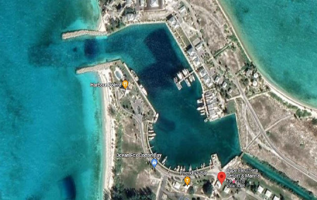
An Aerial View of the Cape Eleuthera Marina Basin
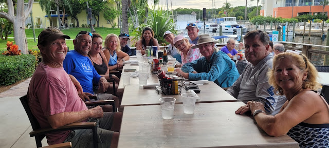
The Group Dinner at Cape Eleuthera's Harbor Point Restaurant

On the second day we took Ghost Rider about 10 nautical miles to the south, near Davis Harbour on the west side of Eleuthera, to check out the fishing.  In that area the water depths drop off sharply very close to the shoreline, and trolling the ledges can produce some nice fish.  We lucked into a swarm of bait-feeding sea birds and found ourselves with a double-header hookup.  Whatever was on Chelle’s line bit the leader in half (Wahoo or Barracuda?), but Rick’s line produced a nice 30-inch Mahi.


Friday, 16-June: To Staniel Cay

Since our next leg was a short one (about 40 nautical miles to the southwest), after a mid-morning departure from Cape Eleuthera we first diverted north and east about 10 miles towards Rock Sound in search of a plane wreck site to snorkel.  The GPS coordinates that Ron had provided were accurate, and in 10 feet of very clear water the plane’s wings were easy to discern, providing structure for a variety of sea life.  From there we went a few more miles further east into Rock Sound, in search of a “blue hole” that Bob noticed on the Explorer Chart.  It took a little dead reckoning and all four boats in an impromptu search pattern, but eventually we found it – a circular sinkhole depression in an otherwise flat limestone seabed. 
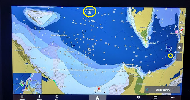
The Yellow Circles on the Chart Display Mark the Plane Wreck & Blue Hole Locations

The chart indicated the hole had a 16-meter depth (50 feet vs. the surrounding 6-8 feet).  These holes occur all over the Bahamas, but generally don’t feature much sea life, as they tend to be anoxic with poor water circulation.  As blue holes go in the islands, it was quite modest – “Dean’s Blue Hole”, about 140 miles south of this one, is the world’s second deepest at 660 feet.
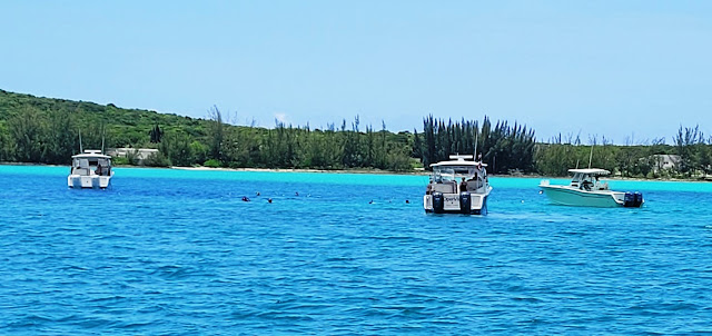
Snorkeling the Blue Hole

Shortly after noon all boats retrieved their snorkelers and we headed south and west to Staniel Cay in the Exumas chain.  In smooth water and pleasant weather we were at Staniel Cay Yacht Club (SCYC) in under two hours.  Once there, however, it took another hour to get dock assignments and tie off – their staff and dock hands were definitely on “island time.”  Visitors should note that the current absolutely rips through this area, and you can find yourself drifting into very shallow shoals if you don’t pay attention.
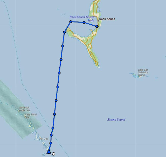
Our Track from Eleuthera/Rock Sound to Staniel Cay
An Aerial Shot of Staniel Cay Yacht Club (SCYC)

Staniel Cay is a small island – about 1.7 miles in length, a half mile wide, just big enough for a 3,000 foot runway, with a small and mostly unprotected marina (SCYC) bolted on to its west side, and some small cottages perched on its steep slopes.  It’s likely none of that would be here except for a few famous nearby attractions just to the north: the Thunderball Grotto, and Pig Beach on Big Major Cay.

Of the two, the grotto – a series of underwater caves – is definitely the better experience, and well worth the long journey to get there.  Significant tidal flows and resultant currents don’t make that simple (wait for low tide and slack water), but once inside, it is rather stunning.  We rented a small Boston Whaler skiff to make it less of a hassle, but even then the smooth limestone seabed makes setting an anchor in any kind of current a real challenge.  You can read more about the grotto at this LINK, along with some of the movies filmed there (including its namesake 007 movie.)


Inside the Thunderball Grotto

Not far away, about a 1.5 mile boat ride to the west and north, is Pig Beach (LINK).  Uninhabited (well, except for the feral pigs and transient touristas), Big Major Cay’s other significant draw is its large anchorage, protected on three sides; dozens of monstrous yachts were moored there.

As for Pig Beach, it would be more accurate to call it Hog Beach, as most of the swine there are large and very well fed, and definitely not shy; several of them were suitable for a riding saddle.  You can hand feed them, but if you don’t and have food in hand, they will come and take it anyway (as sister Lin discovered), without much regard for your desire to remain upright.  And yeah, they can swim.

The next day we were planning to join Ron aboard Open View for some fishing in Exuma Sound, but the weather didn’t cooperate.  Thunderstorms, with high winds and lightning, swept the area most of the day, and the boats got rocked pretty good by the southerly wind-driven waves.  It turned out to be a good day for a nap in the air conditioned cabin.  Since we were staying aboard the boat, and SCYC had no shower facilities, we made use of Lin’s cabin for nightly showers; while it was small, it was clean and bright, with a great view of the harbor area – she loved the idyllic setting.  We had dinner at the marina restaurant one night (good food, but you had to submit your order by 1600 and reserve either the 1830 or 2030 seating schedule), but we otherwise prepared meals on the boat.

Lin's SCYC Hillside Accommodations at the Chamberlain Cottages
And It Came with a Nice Water View

 Monday, 19-June: Back to Chub Cay

The afternoon forecast for the Chub area wasn’t promising, so we got an early start at 0730, made our way back through the narrow cut into Exuma Sound, and scooted up the east coast of the Exuma chain until we got to Highbourne Cay.  From there we joined the reversed route to Chub, cutting across the shallow banks again, back through “The Narrows” just east of Nassau, and from their motored in deep water to Chub.  Seas were a little sloppy at 2-3 feet, but following off the stern.  All boats topped off at the fuel dock (no rationing this time) and got tied up at the floating docks before storms raked the marina once again. 

Our Track from Staniel Cay Back to Chub Cay

Tuesday, 20-June: Back to Key Largo

The weather and sea forecasts for the return trip to US waters were looking very good, but all boats wanted to try some fishing in the Chub area before making that dash….so we got started early around 0730.  The four boats fanned out into the deep water – just east of the banks and north of Andros – known as “The Pocket”, supposedly renowned for holding all sorts of pelagic fish.  But as with our attempts last year, nothing materialized over the next 90 minutes.
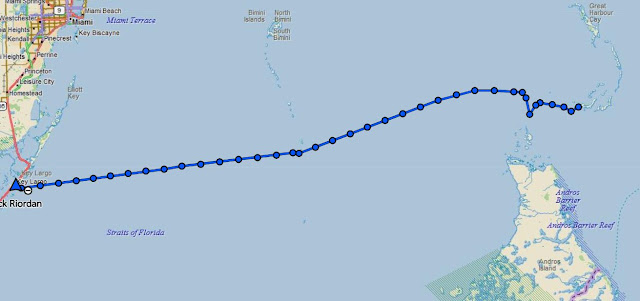
Our Track Heading Back to Key Largo with a Deviation to Troll in "The Pocket"

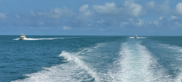
All four boats rendezvoused once again at 0900 at the Northwest Shoal lighted marker, Ghost Rider took the lead, and we headed west, making good time in smooth waters at 32 MPH (about 28 knots on the GPS).  After crossing into the deeper waters of the Gulf Stream through the Riding Rock cut-through, we continued to encounter flat seas and arrived at the Largo canal entrance around 1445.  Ghost Rider had no issues taking on fuel, but the pump ran dry shortly thereafter so others had to head one canal south to the Pilothouse Marina for gas.  We had one last group dinner at Skipper’s and then slept well.

Flat Seas in the Gulf Stream Heading Back to Key Largo

Wednesday, 21-June: RTB

This was RTB (return to base) day for us, with the exception of Dilly Dally, as Bob planned to spend another day or two with friends in Key Largo.  Open View and Little Bird sortied out at 0800 since they had a longer distance to traverse back to PGI and Port Charlotte.  Ghost Rider’s crew slept in a bit and departed solo at 0900.

The run home was uneventful until we came abreast of Naples on the west coast of Florida around 1400, at which time both XM satellite weather and the radar set showed a healthy thunderstorm parked along our route near Fort Myers Beach.  There was plenty of lightning visible, so Rick slowed the boat to a crawl to give the system time to either move or dissipate – he also thought he sighted a waterspout at the storm’s trailing edge near Sanibel at one point, but kept that to himself.  (LINK to video). 
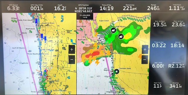
This Thunderstorm Could Not Have Parked Itself in a Worse Spot

About 45 minutes later the storm had split into two cells and dissipated enough to create an alley between them and the coastline that we could run without concern.  And by 1600 we had completed our RTB (as had Open View and Little Bird).  Bob in Dilly Dally returned home two days later (also successfully dodging a thunderstorm along the way.)

Afterword

This was a fun and challenging expedition. 

We thoroughly enjoyed the company of our fellow club members, the journey and the destinations.  And as with most adventurous outings, preparation is as key as the doing.  Anyone contemplating such an excursion is advised to spend at least twice as much time in planning readiness as in anticipated execution.  Whether it’s customs and immigration requirements, or provisioning and spares, country-specific protocols, weather routing, charting and plotting, safety measures, pre-trip maintenance, whatever – there is plenty of prep and anticipation required.  The fun is in pulling it all together and making it a smooth experience once underway.

By the way, Chelle did a terrific job of provisioning our boat and crew for the travels….we had plenty of libations, fresh water, food, clothing and basic supplies all the way….not an easy feat for liveaboards on a small boat in the Bahamas.  She’s the expert for folks who want counsel on such things.  And special shout-out kudos for her “Ever*Chill” instant ice-maker – that thing was totally awesome….one cannot enjoy good scotch or a Goombay Ghost without an ample and predictable supply of ice cubes.

These Were All of the Charts Used to Plan & Plot the Trip

Over the 11-day voyage we covered nearly 900 nautical (about 1100 statute) miles, consumed more than our fair share of scotch, rum and wine (after sailing hours at the dock, of course), and burned a lot of fuel – in Ghost Rider’s case, about $5,600 worth.  We were happy to contribute to the American and Bahamian economies, and it was positively well worth it.

Our next sortie to the Bahamas will likely be back to the Abacos, timing TBD, more on that later.

We Exported Our Tracks from the inReach Tracking Site & Imported into
Google Earth for This View of the Entire Journey

Here are a few other pics from the trip....

Sister Lin Enjoying a Smooth Run Enroute to Key Largo on Day 1
Cape Eleuthera
Cape Eleuthera from the East Side (Sunrise Beach)
Lodging at Cape Eleuthera
At Cape Eleuthera Looking West at the Harbor Entry
Cape Eleuthera Pool Area at Sunset
Little Bird, Dilly Dally, Open View and Ghost Rider Docked at SCYC
The Chamberlain Cottages Near SCYC 
Our Four Grady-Whites at SCYC as Seen from the Shoreline
Feeding the Nurse Sharks in the SCYC Marina Basin
Another View Inside the Thunderball Grotto

Sunday, June 26, 2022

June 2022: Back to the Bahamas

Our Tracks To & From the Bahamas
The last time we attempted to visit the Bahamas was the spring of 2020.  In March of that year we took our previous boat, a Nordhavn 50 also named Ghost Rider, around the horn of Florida to stage our crossing from Palm Beach – and then Covid intervened.  The islands shut down all entries from foreign ports, the “All Hands and Hearts” charity operation to whom we were about to deliver a load of building materials withdrew their personnel from Marsh Harbor, and we got stuck on the wrong coast of Florida. (Previous blog links start HERE.)

Thus, it had been since the April-May 2018 timeframe since we had the pleasures of cruising Bahamian waters (more past blog links begin HERE), and we were determined to give it another shot.  Rick had the boat all caught up on maintenance, and Chelle had completed her typically thorough job of provisioning, so it seemed to be a good time….the rapidly rising price of fuel and nearly everything else notwithstanding.

Serendipitously, our local Grady-White boat club had a similar plan, so Ghost Rider and three other boats set off together to head towards Chub Cay in the Berry Islands.

Wed, 8-June, Fort Myers to Key Largo

After departing our dock around 0820 we rendezvoused with our three buddy boats – Fin & Tonic, Grady Lady II and OpenView just off the southern tip of Sanibel Island around 0850, and with Ghost Rider taking the lead headed south towards Cape Sable and the Florida Keys.  Weather was typical for a June morning in southwest Florida – already warm at 85F, mostly clear skies, winds from the southwest at around 10-15 knots from the southwest.  Seas were a tolerable two feet at short intervals with a slight wind chop on top.

A Couple of the Other Three Boats Following Us Down to the Keys

Almost immediately the port engine threw a “water-in-the-fuel” warning….not a great start.  The engine was running just fine, so we decided to continue – if it began to stutter then we would stop and diagnose further.  As it turned out the Yamaha 425 XTO continued to operate normally all day (well, other than the very annoying warning beep that persisted at 15 second intervals.)

About three hours later, as we were approaching the west coast of Cape Sable, we picked up a building thunderstorm to our southwest, both on our XM weather display and verified by real time radar.  It was moving slowly towards the east – directly into our path – and it was emitting some serious cloud-to-ground lightning.  We diverted the group to the southwest and scooted around the backside of that cell, and just in front of another one in the early building stages.  Overall it was about a 12 mile diversion, but it beat messing around with Ma Nature’s high voltage, and we still arrived at Key Largo just after 1500. 

We Diverted to the West (Right) to Avoid This TRW Cell on the First leg South

The waterway leading into Marina Del Mar (LINK) is interesting, mainly because it has a 90 degree bend in it – referred to as “Crash Corner” (for good reason) – and is fairly narrow when vessels are moored on both sides, which is the norm.  It’s like boating down a bowling alley.  And it can get busy, with numerous commercial fishing charters transiting daily along with several dive boat services headed to and from the John Pennekamp Coral Reef State Park just offshore.  It is expected practice for both inbound and outbound vessels to announce an approach to Crash Corner on VHF channel 16, which has cut down considerably on collision incidents there.

Aerial Shot of the Canals Leading into Marina Del Mar in Key Largo....the Green Arrow Marks
the Entrance, the Red Arrow Points to "Crash Corner"

Once docked up and after the usual washdown routine, Rick removed the port engine’s cowling and secondary on-engine fuel filter (where the fuel water sensor is also located), and verified there was a trace amount of H2O in the cup.  So he removed the primary fuel-water sep filter on the bilge bulkhead and dumped that into a pan, where more water was found.  We had spare filters on board, so after a quick swap-out and some dock testing, the water alarm was gone and the system operated normally thereafter.  We suspect some sea water entered the main fuel tank through the vent during rough seas on the previous Loop trip….the starboard engine is fed fuel by the separate aux tank, which experienced no water ingress.

Snapper's Restaurant at Marina Del mar in Key Largo

Thu 9-June, Key Largo

The next day was mostly a down-day to make final preparations for the Gulf Stream crossing to the Bahamas on Friday.  Preps included fueling up the boat, a visit to West Marine for some more spare fuel-water sep filters (just in case), checking the next day’s weather and sea conditions, and getting a Covid-19 test at the local Walgreens; that was required to obtain the “Health Visa” for entry to the Bahamas.  (Note – the following week that requirement was discontinued.)  We concluded the day with a group dinner at Snapper’s, the marina’s onsite restaurant, and completing the “Click-2-Clear” applications for entry to the Bahamas.

The Fuel Dock Just Around the Corner from the Marina

Our Whole Group Getting Ready to Chow Down at Snapper's

Fri 10-June, Key Largo to Bimini

At only 72 nautical miles, the crossing from Key Largo to Bimini is not a long one, but it can be miserable (and sometimes a bad idea) in certain conditions.  The Gulf Stream runs due north in that area, at anywhere from 2.5 to 5 knots, and if it collides with a brisk wind from the north, it can get very rough.  This day, however, we had a good forecast (southeast winds 10K or less) with warm, clear skies, and reality matched.  Our flotilla cast off lines at 0800, and with Ghost Rider in the lead, cruised smoothly across 1-2 foot seas at 30 MPH (about 26 knots on the GPS), arriving at the North Bimini entrance channel at 1100.

Overhead View of the Entrance Channel to North Bimini & Big Game Club Marina

We were also fortunate to arrive at a low tide and slack current (it can rip through there), and before 1130 all boats were securely tied up at the Bimini Big Game Club (LINK).  It took a couple of hours to process through immigration and then customs, but after that we took down the yellow quarantine flag, replaced it with the Bahamas courtesy flag, cleaned up the boat and ourselves, and chilled out with lunch and cold beers.

There was also pool time and another group dinner at the Big Game Club’s outdoor restaurant – fun atmosphere, average food.

Ghost Rider Docked at the Bimini Big Game Club with Courtesy Flag Deployed

The Group Dining at Big Game Overlooking the Marina Basin

Sat, 11-Jun, Bimini to Chub Cay

We had more decent weather the next morning, at least at the start, for the 85 NM run to Chub Cay at the southern end of the Berry Islands.  There were some small storm cells to our east, but moving north, opposite from our initial southerly direction towards the Cat Cays.  So, at 0900 we headed out.  We made a short diversion to check out a relatively new marina at the far south end of that island chain (might be worth a future visit), and then turned towards the east and Chub Cay.

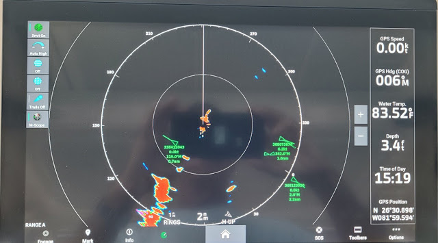
About halfway through the leg a line of storms began building ahead of us, and while they were moving to the north, the line was long and contiguous enough that we had to pick our way through the least threatening portion.  The radar and the XM Weather displays were helpful in determining the best path, and in the end we just got a decent rainwater washdown and no signs of lightning, although the wind chop increased some.

Chart and Realtime Radar on the Left, XM Weather on the Right After
We Had Punched Through the Line of Showers

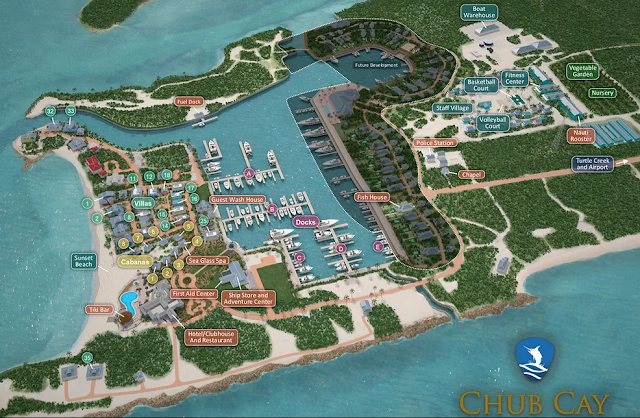
We poked Ghost Rider’s bow into the Chub Cay entrance channel before 1600, and along with OpenView headed straight to the fuel dock, while Finn & Tonic and Grady Lady proceeded to their assigned slips.  The Chub Cay Marina (LINK) is fairly new, very modern with concrete floating docks, and quite large, with excellent resort facilities on the grounds.  After topping off fuel tanks and giving the boat the usual spa treatment, we had plenty of time to relax, and to tend to one small boat issue. 

Entry Channel to Chub Cay Marina & Resort
Layout of the Marina & Resort Grounds

Earlier in the day, prior to departing Bimini, we had started the generator so we could use the boat’s refrigerated fish box and cooler for some ice and frozen food; but the genset was only putting out 95 volts instead of the normal 120.  Rather than delay the departure we opted to do without, and now it was time to troubleshoot it.  Fred Grainger, a tech with our local Grady-White dealer back home and crewing on Finn & Tonic, knew exactly what the root problem was.  The 5KW Fischer-Panda apparently had a habit of burning out the boost board – basically a PCB that controls throttle and RPM according to the AC loads being applied….all we had to do was disconnect that board and the wires going to the throttle actuator, then zip-tie the throttle lever open to a fixed RPM setting that would maintain 120 volts with the typical loads applied.  A more permanent fix would wait until we returned home.  (See “Aftermath” below.)

Close Up of the Generator Workaround....Yellow Arrow (Far Right) Points to the Terminator
Plug Disconnected from the (Bad) Boost Board, Blue Arrow Points to the Disconnected
Actuator, and the Green Arrow Points to the Black Zip Tie Fixing the Throttle Lever
to a Fixed RPM.

Thinking we were all set for two full days of fishing in the nearby “Pocket” (more on that shortly), the entire group headed for dinner and drinks at the nearby Nauti Rooster, a classically Bahamian dive just down the road.  It was actually an easy walk, but the Rooster was also providing golf cart rides from the docks.  Our group numbered 14 total including guests, so we rode in shifts; on the last shift the cart was a bit overloaded, the driver was a bit careless and somewhat rambunctious with turns, and as it wheeled into the shell-paved parking lot it rolled over on its side.  There were various cuts and bruises among the occupants, but by far the worst was to Candy – wife of Andy, both guests of Ron and Brenda aboard OpenView….she could not stand or walk without assistance and was in considerable pain.

We were fortunate to have a medical doctor among our gang – Julie Langer on Finn & Tonic – and while medical supplies were a bit lacking, expertise and attention were not.  Julie suspected a fracture in either the hip or pelvis, but regardless it was obvious Candy’s boating days were over for a while.  A day later, along with Andy she was flown on a private plane to Nassau, thence back home to the States, where she is recovering from a busted pelvis – and will fully recover.

Sun-Mon, 12-13-Jun, Chub Cay

It was time to go fishing, specifically trolling for mahi, tuna, maybe a Wahoo or Marlin.  Ron, from OpenView, and Tony and Julie from Finn & Tonic jumped aboard Ghost Rider, and on a perfect summer day in the Bahamas (sunny, warm, seas 1-2 feet), we were trolling in the “Pocket” by 0930.  The Pocket is a roughly triangular shaped body of deep water just southwest of Chub Cay where depths drop to thousands of feet in very short order, and is known for being very productive fishing grounds.  We ended up proving that there also can be some occasionally poor conditions that produce few fish.

Chelle at the Helm, Julie & Tony Trying to Be Patient While We Hunted Fish in the Pocket

On both Sunday and Monday we spent hours on troll patrol and ended up boating only two Blue Runners and two barracuda, both of which make decent bait but lousy eating.  The local charter experts were reporting similar results, with blame generally placed on poor water clarity and high flows pushing the bait and pelagic fish much farther to the east than normal.  In any case, Chub Cay was a very nice place to hang out, but the fishing experience was totally unimpressive.

Docked at Chub Cay....OpenView on the Left, Ghost Rider on the Right with Outriggers Up

 Tue, 14-Jun, Chub Cay to Bimini

It was time to start making our way back home, so by 0915 on Tuesday, 14-Jun we were underway, backtracking towards North Bimini so we could clear outbound customs there.  Ghost Rider took the lead again for a very smooth return ride in very pleasant conditions.  A few of the boats stopped off at the old Sapona shipwreck (LINK) on the inside of South Bimini to do some snorkeling, while we poked our nose out into the Gulf Stream to the west of Bimini for one last shot at trolling – but with no luck.

The Sapona Shipwreck Remnants Just East of South Bimini

By 1330 we were back in the North Bimini entrance channel and shortly thereafter we were again docked up at the Big Game Club in Alice Town….after dealing with some hefty current flow on a swiftly moving outgoing tide.  We cleaned up the boat, cleared customs, grabbed another meal at the marina restaurant, and rested up for the next day’s sortie back to the USA.

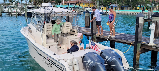
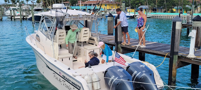
Tony & Julie on Their Marlin 30, Finn & Tonic, along with Crew Fred & Julia Grainger,
Getting Squared Away at the Bimini Big Game Club

Wed, 15-Jun, Bimini to Key Largo

Conditions were about perfect the next morning’s 0900 departure…warm temps, light winds, flat seas and clear skies.  Even with briefly pausing at a gas dock (very briefly – they were out of fuel) in the Largo canal, we were docked up again at Marina Del Mar by 1230.  The problem was both fuel docks in that immediate area were out of gasoline, and lacking sufficient reserves to make the next day’s run back, we went hunting via the Web.  Eventually we found one just a few canals over, albeit at a premium price:  $7.49 per gallon at the Pilot House (LINK)….where we took on only enough for the leg back to Fort Myers.

The group has its final supper together at nearby Sharkey’s Sharkbite Grill (LINK…good food and drinks there) and called it an early night after checking the next day’s weather forecast – which again looked quite good.

 Thu, 16-Jun, Key Largo to Fort Myers

We opted for a slightly earlier start on the final day since the other boats had a longer way to go to RTB than we did (anywhere from 10 to 25 miles further north.)   But once again the flotilla had ideal conditions, mimicking the previous day’s weather.  Ghost Rider led the formation down Hawk Channel to the Channel Five bridge, cutting north there to the bay side, through the dogleg turns at Yacht Channel, and then north paralleling the west coast of southern Florida.  We had nearly flat seas the entire sortie, arriving back at our home dock by 1415.

Our Small Fleet Making Its Way Out of the Largo Canal to Head Home

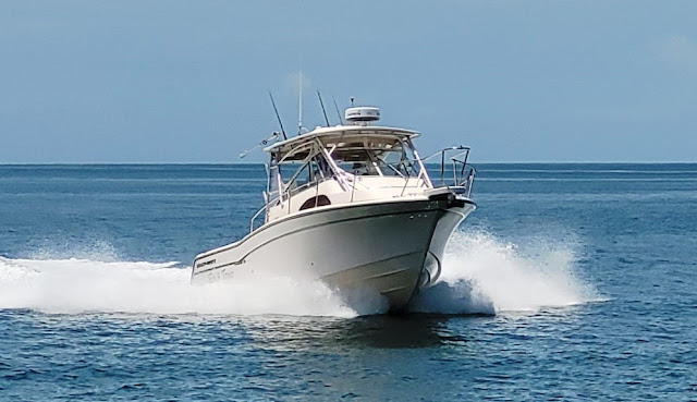
Finn & Tonic Flying Our Wing on the Last Leg Home

Aftermath (Boat Business)

Generally the boat performed well.  The water-in-the-fuel issue on the initial leg actually caused no performance issues and was easily resolved with filter changes.  On the final leg home we also got one of those transient (and very generic) error codes again on the port engine, also causing no operational issues – we continue to suspect poor error handling by the Yamaha computer software.

The generator was a slightly different story.  While the workaround fix for the low voltage output was simple enough to implement, the permanent repair required ordering both a new boost board and an actuator (they work as a pair).  Rick was able to effect the replacements in short order, and the in-water test verified proper operation.  (The old board looked deep-fried.)

Old Boost Board on the Right...Not Too Difficult to Figure Out Why It Quit Working.  The New Boost Board (Left) Appears to Be a Much Different & Beefier Design.

New Actuator (Far Left) to Replace Old One (Green Arrow.)  The Yellow Arrow Points to the
Boost Board Housing...the PCB Board Just Slides In/Out.

Finally, Rick had grown weary of the poor quality Garmin VHF radio – the microphone had developed transmission issues (the second one in a year), it lacked AIS, and even when working properly produced lousy audio.  So that got replaced with a new Standard Horizon GX2400.  The old Garmin 215 model will make a good doorstop.

New Fixed Mount Standard Horizon GX2400 VHF Radio Installed with the Standard
Horizon HX870 Handheld Unit to Its Right as Backup

Now We Have AIS Tracking on The Chartplotter & Radar Displays via the New VHF

Looking at the Tropics

It appears that we will have at least one new tropical system spool up in the next week or two (currently named Invest 94L), although the long range models so far are taking its track well to our south, so not likely a factor.  The good news in this realm is that we’re past the early season where such storms tend to originate in the Gulf or Caribbean, and into the summer phase where waves coming off of Africa are the threats to watch – meaning there is a lot more warning time.


Upcoming

We plan to head back down to the Florida Keys (Marathon area) in the middle of July for a week, and hopefully (finally) put plenty of keeper mahi in the fish box.  Assuming the tropics continue to cooperate, we’ll post an update on that towards the end of July.

 Additional Pics Follow

Heading South on Day One

Fred Destroying a Yellowtail Snapper for Dinner in Key Largo
Ghost Rider at the Fuel Dock in Key Largo


Big Game Pool Area

The Crew of Grady Lady II...John, Theresa, Ellen & Brian
Brenda Aboard OpenView (Ron Hiding)
The Crew on Finn & Tonic....Tony, Julia, Julie, Fred...Along with Theresa
Chub Cay
Chub Cay Prices @ the Fuel Dock

Chub Cay
Chub Cay
Chub Cay

Chub Cay
Chub Cay
Chub Cay
Chub Cay
Chub Cay
Chub Cay
Chub Cay
Chub Cay
Chub Cay
Chub Cay
Chub Cay....Emptied Conch Shells
Conch Out of the Shell....Cooked Bahamian Style ("Cracked") in Chub Cay
Group Farewell Pic @ Chub....Minus Andy & Candy